Leeham News and Analysis
There's more to real news than a news release.

 Leeham News and Analysis
- Dissecting Boeing CEO’s statement next new airplane will cost $50bn April 15, 2024
- Bjorn’s Corner: New engine development. Part 3. Propulsive efficiency April 12, 2024
- A350-1000 or 777-9? Part 2 April 11, 2024
- Pontifications: Boeing “transparency”–not so much. April 9, 2024
- Airbus charges and write-offs since 1999: more than €33bn April 8, 2024
Putting the MH370 search in perspective–literally
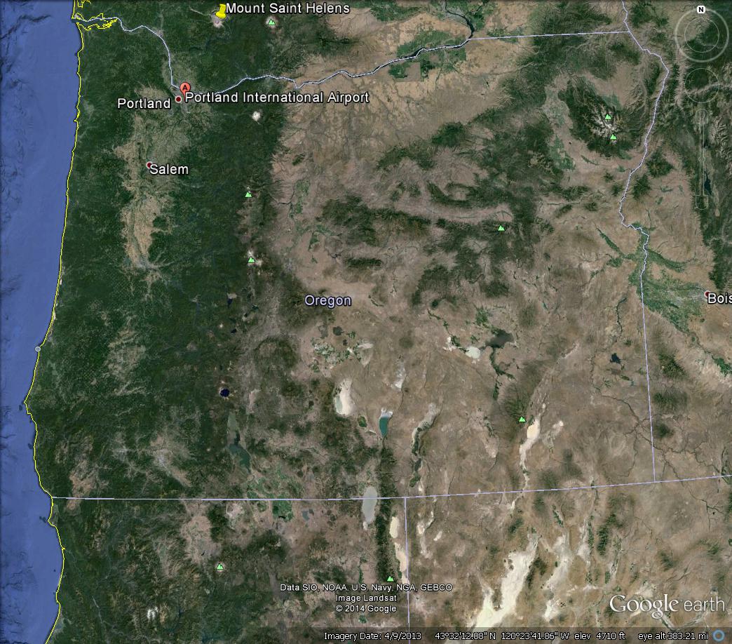
The search area for Malaysian Airlines Flight MH370 now encompasses an area the size of Oregon. So we pulled it up on Google Earth and marked the Portland International Airport. You can’t see the airport let alone a Boeing 777. This illustrates the task at hand.
Then we zoomed in on PDX Airport, though we don’t know what “altitude” this represents; we’re not smart enough to take a measurement of the airplanes (a known size) and extrapolate to compute the altitude–we’re sure some of our readers are.
Read the Comment from Andrew about the altitude (and our response).
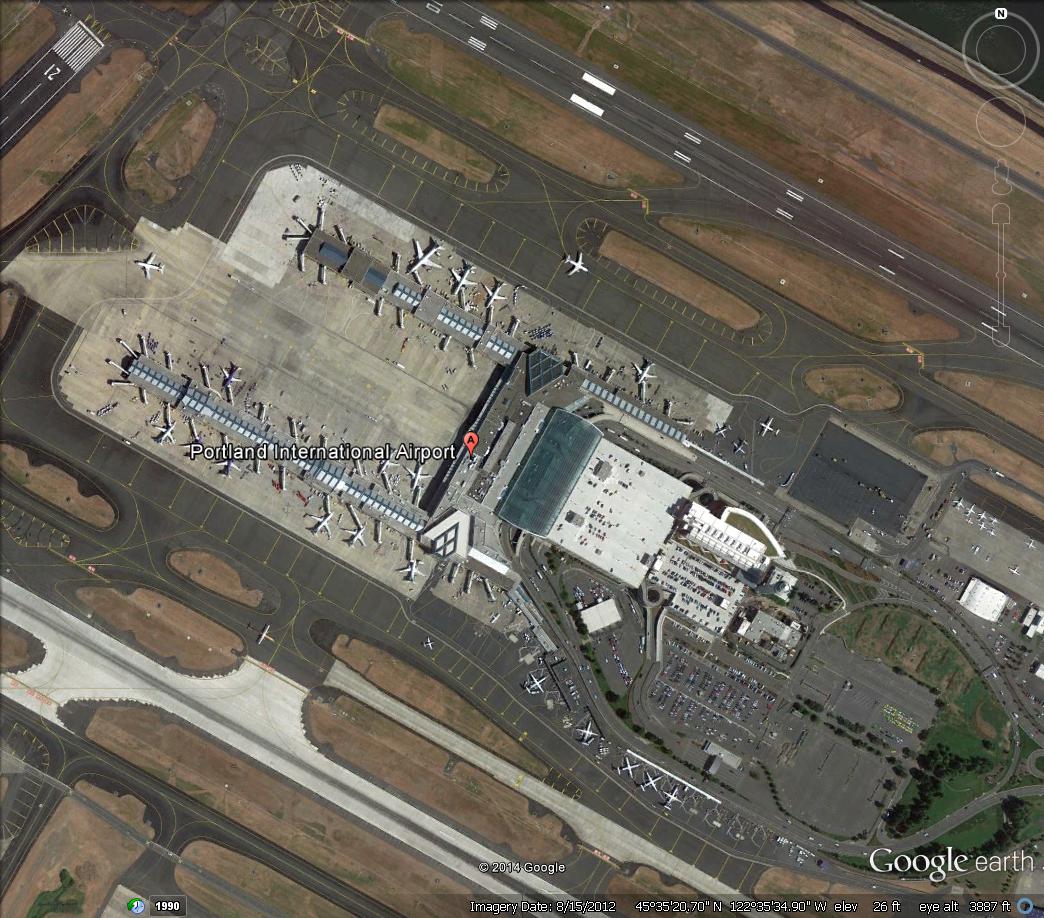
Airplanes, intact, are clearly discernable but cars are mere specks. Baggage carts and ground equipment around airplanes are smaller still.
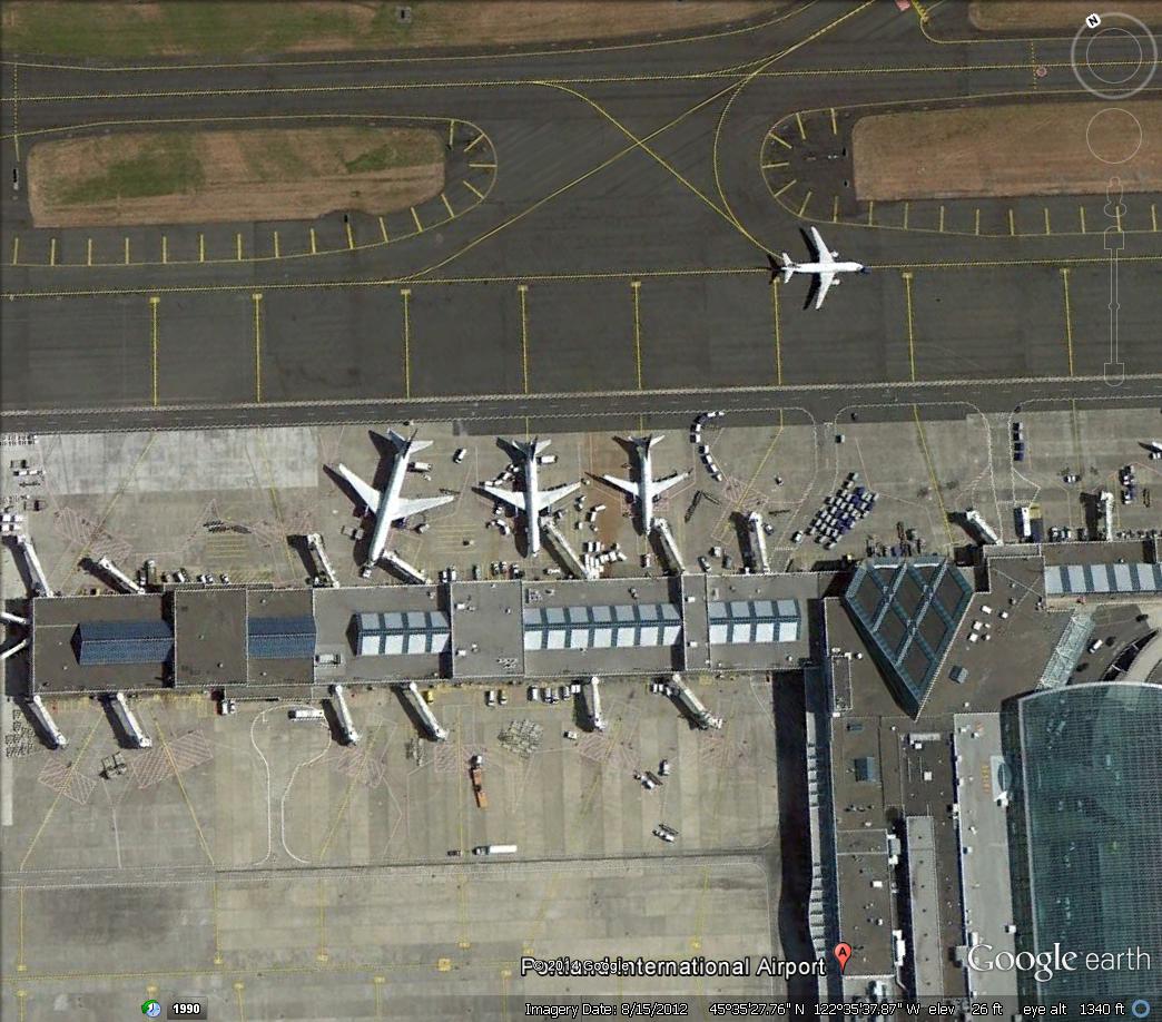
The we zoomed in closer, from a still-unknown “altitude,” (see Reader Comments) and more small objects can be seen–but now imagine if you were looking for debris.
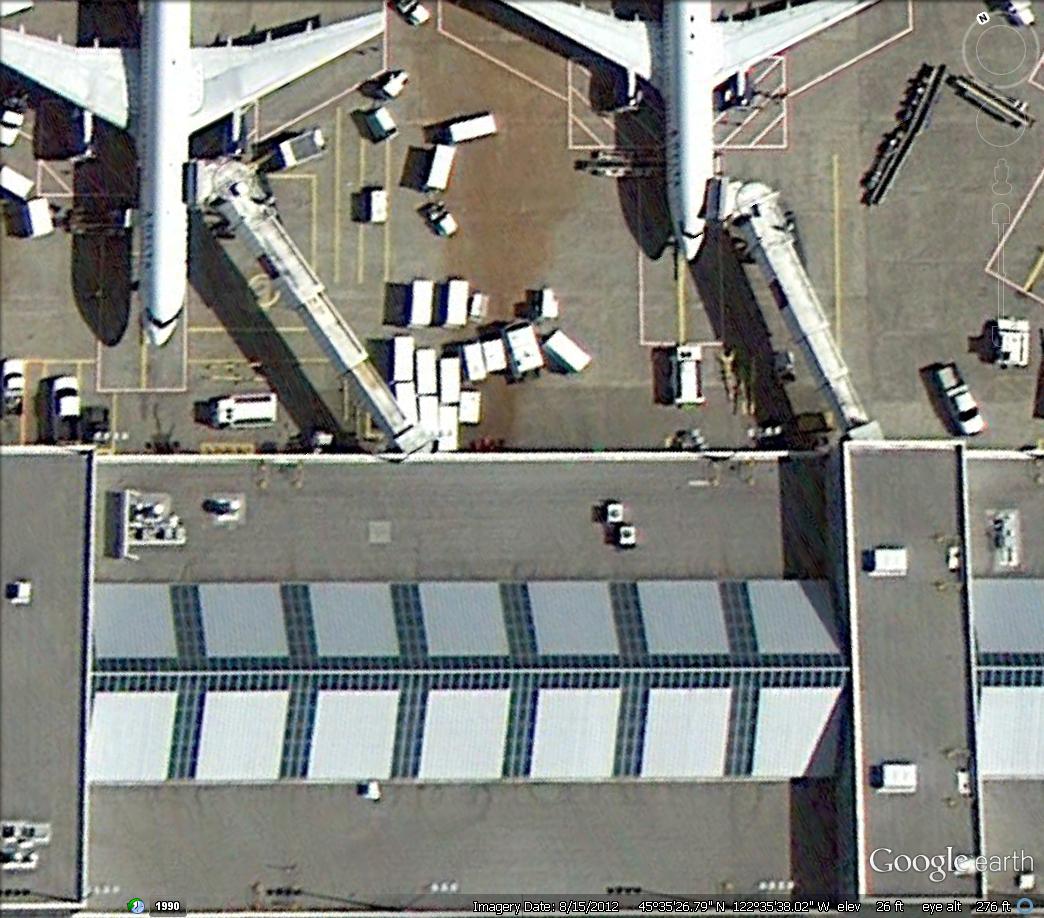
And then finally, a low level “flight” where cars and trucks are clearly visible-but once again, imagine looking for debris such as seat cushions, insulation blankets, life jackets, etc.
In the bottom photo to the right of the airplane and jet bridge near the building you can see a white truck. Look in the same location in the photo above the bottom picture and the truck is there–but it’s almost unrecognizable as a truck.
This gives you an understanding of the enormity of the task.
- In our Greg Feith interview, he opined searchers may never find the wreckage. We received a Tweet reply noting that people did find the Titanic. We countered that it only took 73 years to do so.
Hi Scott
It says at the bottom right of each Google Earth image what altitude you would be looking from.
Top to bottom, the first is 383 miles, the second 3,887ft, the third 1,340ft, and the fourth 276ft.
Cheers
Andrew
Boy, talk about fine print. These old eyes didn’t even see that!
Press reports said the airplanes were flying at about 300 ft so the fourth picture is pretty close to what air crew would see.
I really have to laugh. Andrew’s email address begins with “magoo”–as in Mr. Magoo….
Are these altitudes supposed to be equivalents, or actual? I would think that permission to overfly a non-trivial airport at 276 ft to take pictures would be rather difficult to obtain. If that is indeed the case, that these are “equivalents,” I have to wonder how the resolution of the imager, at whatever altitude it was actually, comes into play when it comes to recognizing items.
Ask Google
Google Earth foto’s are taken by sattelite, not overflight. zoom level is approximate ofcourse.
For Germany the high resolution imagery is ( used to be? ) derived from overflights afaik.
No idea how this is handled for other regions.
Equivalent viewing height isn’t all that expressive.
Look for the number of same size images to view the same area dependent on resolution for that.
“Oregon” :: 251,419 sq km
“777” :: 0.0049 sq km
That is about a 2 million to 1 relation.
High School nickname which has stuck with me for 30 years!
The search altitude would depend on the search platform. The P-3s and P-8 are likely flying at 300-500 feet, the civil aircraft a little higher (1000-2000 feet), and the Chinese transports higher still.
So photos three and four really give Readers an indication of what air crew see.
For Readers’ information, Andrew is a former aviation journalist in Australia.
Actually the P-3s and P-8s have high resolution optics and cameras, so they can get a clearer picture of the objects.
USAF U-2s can photograph larger areas in a short amount of time. Some cameras mounted in the U-2 can give better than a 1 meter resolution from FL-700+. Public rumors have for decades claimed these cameras are capable of reading a vehicle license plate from very high altitudes. I wonder why they are not being used?
Then there are the spy satellites from the US, France, UK, China, Russia, and others that claim they can pick out guards around an ICBM silo.
Instead we get fuzzy pictures from satellites of debris fields, none of which have been proven to be from MH-370. We know large pieces of an airplane wreckage will float. AF-447 (A-330), AA-587 (A-300), AI-855 (B-747), and PA-816 (B-707) all crashed, or dropped parts of the aircraft into water. All were vertical tails and all floated. However MS-990 (B-767) and TW-800 (B-747) both entered the water at angles that destroyed large parts of those airplanes. But pieces of each airplane still floated.
Here is one source for commercial satellite images: http://www.tomnod.com.
Take a break and search …
And all of this assumes you have perfect vision looking through air. Our task is to find a broken airliner looking through a soda straw and 10,000ft of water. I mentioned this in another thread – but I’ll do it again here:
If all of LA was the Indian Ocean – the aircraft would be about the size of a dime. Our underwater searching device would be the size of an ant and could “see” out to about the size of a basketball, and it can travel about 2 feet per hour. We have 2 of them. Now go start looking for the dime. How long would it take a basketball rolling around LA at 2ft per hour to run across that dime. THAT is why this is a hopeless venture.
At this point we should spend the resources upgrading current fleet of aircraft with FDR’s that uplink position, bearing, speed and altitude. In the mean time ICAO and FAA should mandate that carriers subscribe to the full ACARS data service that uplinks the same info.
Eventually debris will wash ashore somewhere and the closure for the grieving families should begin. But lets not kid ourselves about finding this aircraft on the ocean floor. Sadly, it and the passengers who flew on it are gone forever.
What is still bothering me is that these picture of PDX are far better clear than these of object on sea in the past search. With all the spy technology pls don’t tell me that we still need a P Orion to establish visual contact. Shall we expect a temporary no fly zone over us on May 2nd?